Bridge Glacier 2011
Introduction
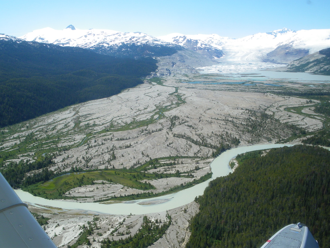
Bridge Glacier is part of the Lillooet Icefield located in the Coast Mountains of British Columbia. Bridge Glacier, like many glaciers in British Columbia, has been retreating steadily since the 1800s leaving uncovering new areas and leaving behind a complex assortment of deposits. This proglacial zone is composed of a range of types of deposits, meltwater streams, and, in the case of Bridge Glacier, a proglacial lake. The proglacial zone of glaciers are very interesting as they are often recently deglaciated and their geomorphology and sedimentological characteristics are shaped by many processes. Additionally, the recent withdrawal of ice from the area in combination with brutal conditions for much of the year makes the study of vegetation within these areas quite interesting.
While several studies have examined the Holocene history of Bridge Glacier using radiocarbon dating of organic debris found in deposits, dendroglaciology, and lichenometry (Ryder and Thompson, 1986; Ryder, 1991; Allen and Smith, 2004), none have throughly examined the characteristics of the deposits in the proglacial area. The only study to simplistically map out the deposits present in the proglacial area of Bridge Glacier is that of Ryder (1991) who studied a sequence of ice-marginal lakes in the South Creek tributary valley (see Fig. 3). Ryder (1991) proposed that the large areas of outwash in the southern half of the main valley likely originated from a series of catastrophic floods that originated from the breaching of the ice dammed lakes between the end of the 19th century and near the beginning of the 20th century.
Using spatial data derived from air photos and attribute data collected in the field, this study will use several types of spatial analyses to look at a range of variables across the proglacial zone in order to determine if there are any patterns present within the different areas of the proglacial zone.
Project Objectives
- To take attribute data collected in the field and relate it to spatial data derived from air photos
- Examine the spatial distribution of variables across the proglacial area
- Determine if there are any patterns within the variables using several types of spatial analyses (Trend, Hot Spot, OLS)
- Locate areas of interest that have been highlighted by the distribution maps and/or the spatial analyses maps
